tva logoTennessee Valley Authority

Watauga Reservoir

Powerhouse at watauga dam

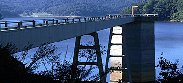
Watauga Reservoir is in northeast Tennessee near Elizabethton. The reservoir extends 16 miles east from Watauga Dam toward the North Carolina border. The photo shows the dam’s sluiceway access tower.

At more than 1,900 feet above sea level, Watauga holds the distinction of being the highest reservoir in the Tennessee River system. The reservoir is managed for many uses, including flood damage reduction, power generation, water quality, and aquatic ecology.

Surrounded by the Cherokee National Forest and flanked by the Appalachian Mountains, Watauga Reservoir is one of the most scenic in the Tennessee River watershed. It offers access to the Appalachian Trail. Below Watauga Dam is a wildlife observation area where visitors have a chance to view unique species of waterfowl.

More information on Watauga Reservoir

Operating guide

Daily reservoir operation information

Sportfish survey results

Sportfish ratings

Ecological health ratings

Recreation facilities

Recreation release schedule


Watauga: Facts & Figures

Construction of Watauga Dam began in early 1942 but was curtailed later that year in favor of other wartime building efforts. Work resumed in 1946, and the dam was completed in 1948.

Watauga Dam is 332 feet high and extends 925 feet across the Watauga River.

Watauga Dam is a hydroelectric facility. It has two generating units with a net dependable capacity of 66 megawatts. Net dependable capacity is the amount of power a dam can produce on an average day, minus the electricity used by the dam itself.

In a year with normal rainfall, the water level in the reservoir varies about 11 feet from summer to winter to provide for seasonal flood storage.

Watauga has a flood-storage capacity of 152,800 acre-feet.


Content for id "future1" Goes Here
Content for id "future2" Goes Here
Content for id "future3" Goes Here